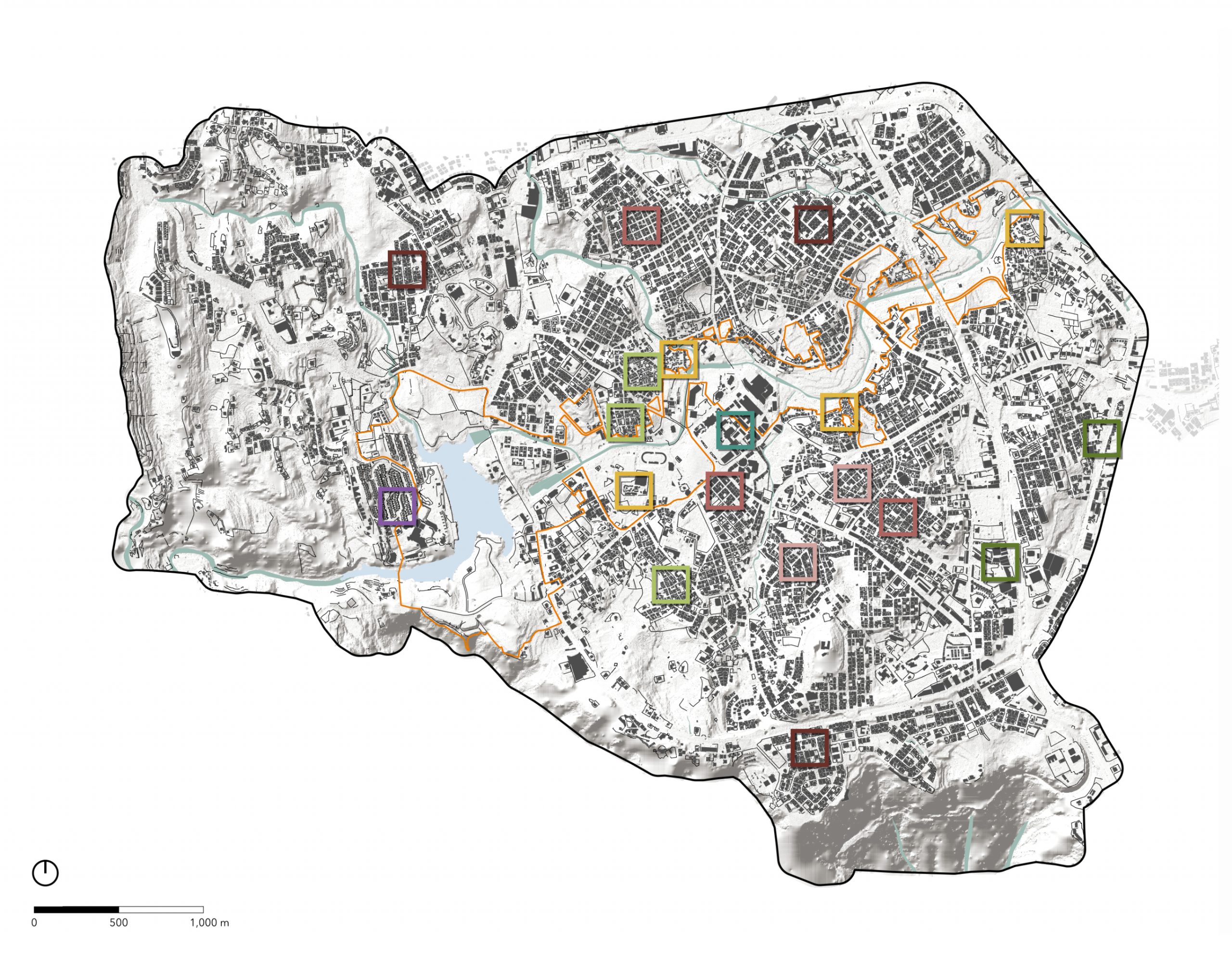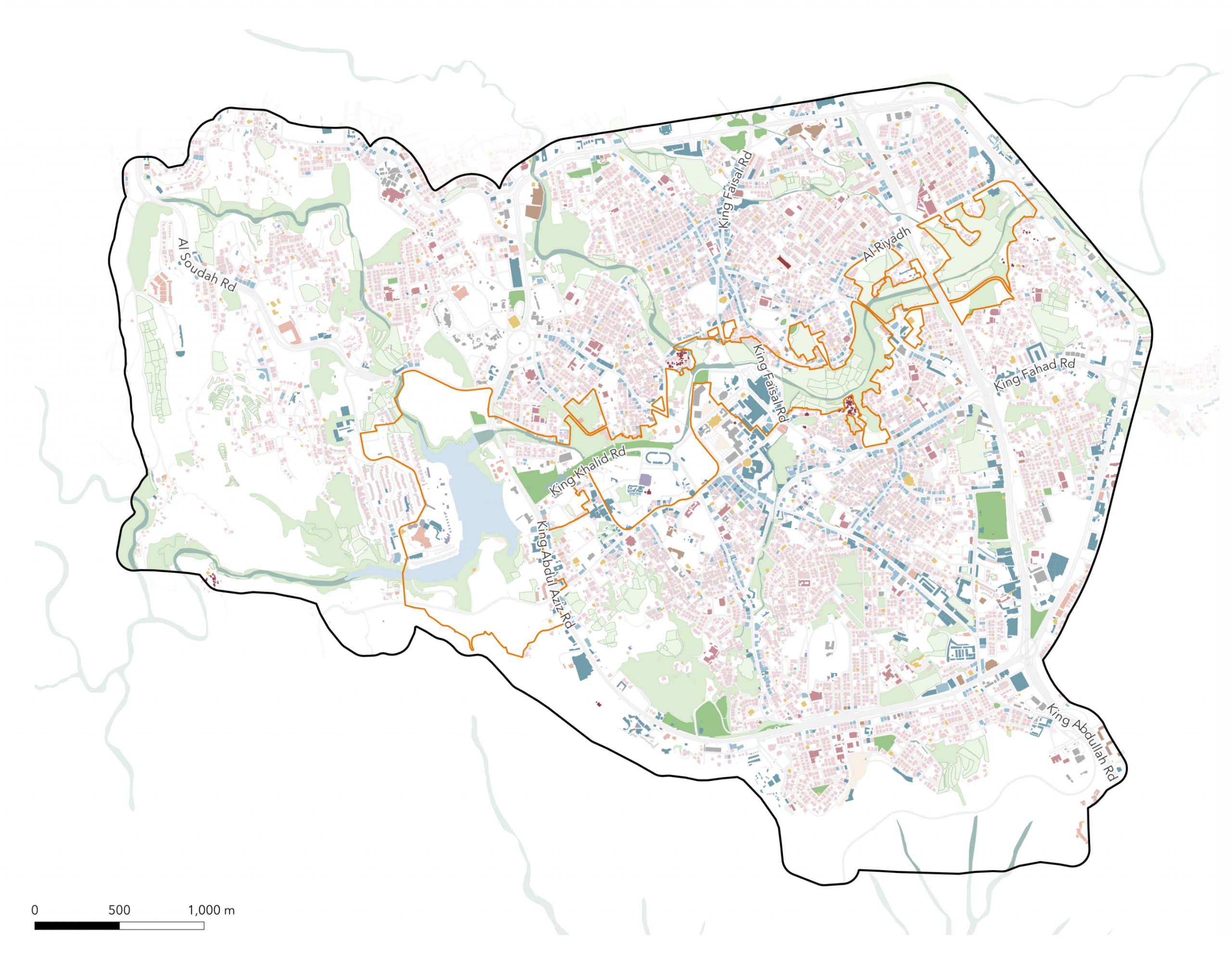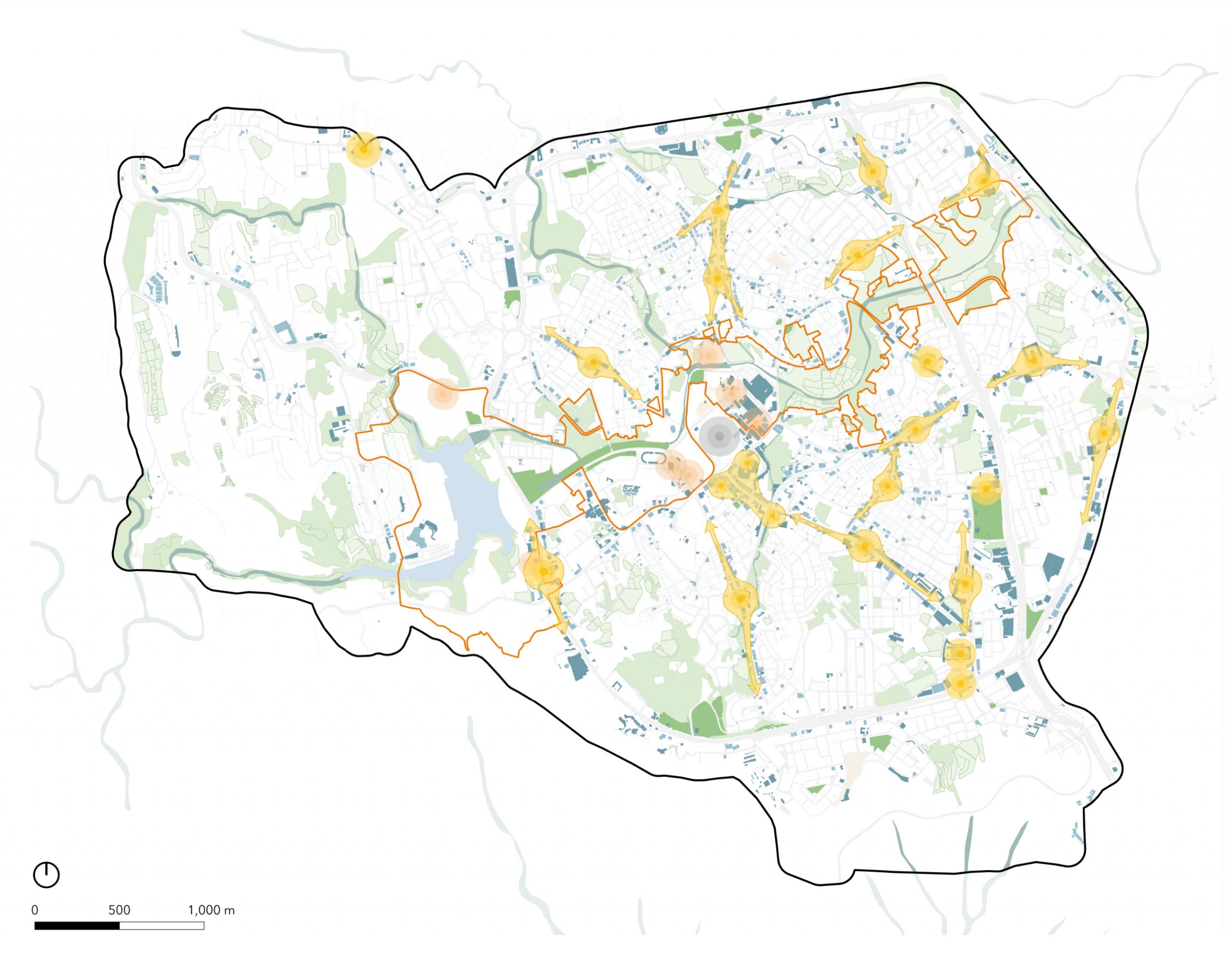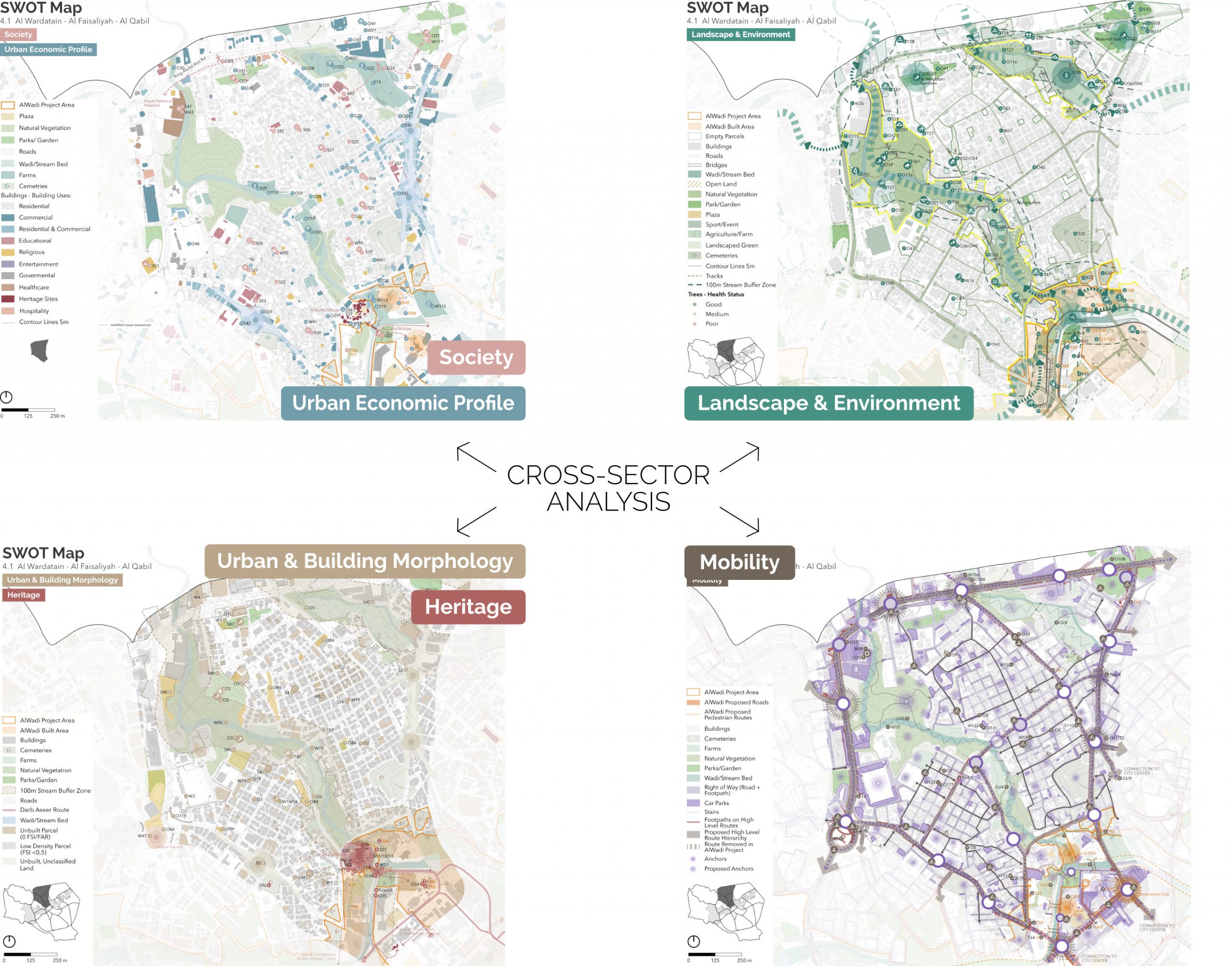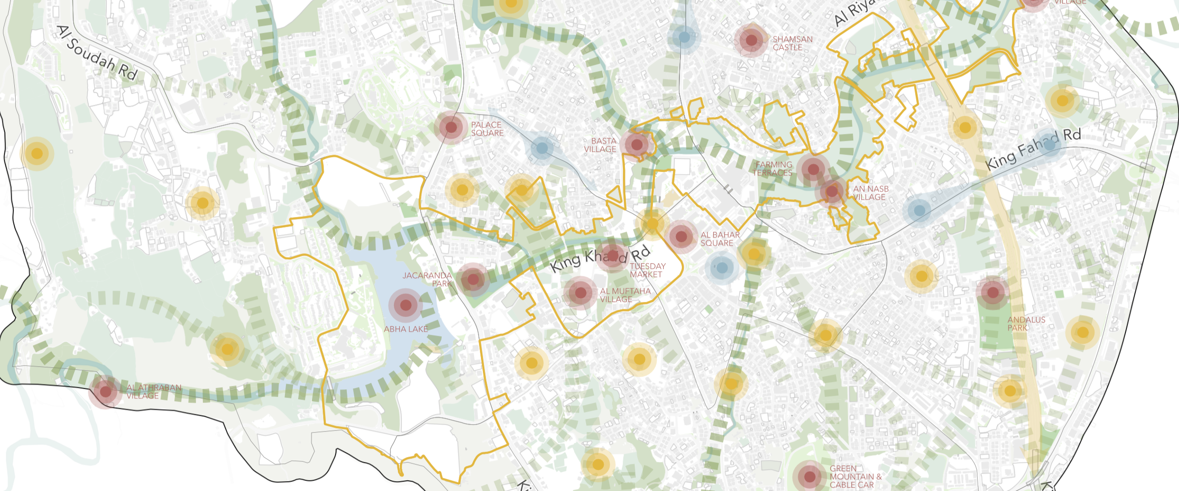
The project is part of a city-wide transformation initiative aimed at strengthening the long-term economic, social and environmental resilience of Abha, the capital of the Aseer Region in the Kingdom of Saudi Arabia. To achieve this, the commissioning authority instigated this comprehensive survey and analysis of the existing conditions focussing on central Abha. The digital survey and GIS-based analysis, combined with a city-wide SWOT assessment, forms the analytical foundation of the project, enabling evidence-based understanding of Abhaʼs spatial structure, socio-economic dynamics and environmental systems.
The overarching programme responds to rapid regional transformation driven by national development priorities, tourism investment, demographic shifts and major infrastructure projects. Therefore, goal is to set out a strategic framework aligning large-scale investments and reinforcing Abha’s intrinsic systems, including wadis, heritage, cultural identity, neighbourhood structure, to generate lasting benefits for residents, local economies and regional identity.
Approach
The project applies a data-informed strategic framework linking city-wide analysis with major investment programmes.
Digital Surveying and GIS Analysis: A comprehensive spatial evidence base was established through city-wide digital surveying and GIS analysis, enabling integrated assessment of land use, mobility networks, environmental assets and development pressures.
City-Wide SWOT Assessment Across Themes: A holistic SWOT analysis identified Abhaʼs structural strengths, vulnerabilities and development opportunities across spatial, socio-economic, cultural and environmental systems.
District Alignment: Findings are identified at neighbourhood scale while maintaining coherence at city scale. This supports strategies that respond to each district and build on Abha’s existing grain, microclimates, views, and social patterns rather than applying uniform solutions.
City–Project Integration: The analysis evaluates major flagship developments with the existing urban fabric, guiding large-scale investments to reinforce the wider city rather than operate as isolated enclaves.
Landscape and Climate Integration: Natural systems, cultural landscapes and climatic conditions are treated as structuring elements of urban development, embedding resilience within long-term growth strategies.
Outcomes
The analysis report establishes a strategic framework enabling major regional investments to generate lasting benefits for the entire city and its wider metropolitan role as capital of the Aseer Region. The strenghts, weaknesses, opportunites and threats together with category level observations and key area recommendations form the agenda of this framework.
Key outcomes include:
A City-Scale Framework for System Alignment: A consolidated strategic reading that links environmental, cultural, social, economic, and mobility systems into a coherent basis for decision-making, recognising that Abha’s challenges are primarily about alignment rather than lack of assets.
City Character Baseline: The analysis captures the city’s defining patterns across urban grain, landscape spaces, centralities, and the public space network. It sets a clear reference for future development to build on Abha’s typical qualities, rather than diluting them.
Neighbourhood-Scale Targeting with City-Wide Coherence: A structured basis for differentiated district responses, strengthening neighbourhood centres and everyday functionality while ensuring interventions reinforce one another across the wider urban fabric. Key areas are identifided per district and SWOT findings are formulated in concise cross-category recommendations.
Flagship Developments Leveraged for District Uplift: Clear integration principles for major projects to ensure permeability, connectivity, and mutual reinforcement with surrounding neighbourhoods, reducing the risk of isolated investment enclaves.
Social Cohesion and Inclusive Access as Planning Priorities: Identification of socio-spatial segmentation risks linked to land-value uplift and demographic change, supporting strategies that mitigate displacement pressures, improve equitable access to public space, and strengthen inclusive everyday urban environments.
Heritage as a Living System: A direction that safeguards authenticity of heritage by maintaining continuity between settlement, landscape, and community use, and by pairing physical enhancement with viable, locally embedded economic and stewardship models.
Wadi and Green–Blue Infrastructure Embedded as Urban Structure: A resilience-first environmental approach that protects wadi continuity, permeability, and ecological performance, while repositioning wadis as active public frontages and experiential networks.
A More Balanced Urban Economy and Year-Round Vitality: A basis for diversification beyond seasonal tourism and high-end real estate concentration, supporting locally anchored economies and improved resilience to vacancy, speculation, and affordability pressures.
Multimodal Mobility and Human-Scale Connectivity: Strategic guidance to rebalance car-oriented legacies through better pedestrian continuity, micromobility potential, and human-scale corridor design, connecting districts, heritage assets, and investment areas into a coherent whole.
The result is a transformation framework to convert project-led investment into sustained city-wide uplift and regional competitiveness. A subsequent phase of more granular urban uplift interventions is currently under scoping.